How to choose your United States map print
Like any new piece of art, you’ll want to think carefully about the style, location, and size of your United States map poster. Take into account the different styles Mapiful has to offer and pick one that suits your home. The colors and style of the map should be taken into account. If you want a statement piece, choose one of Mapiful’s bold monochrome styles. You can also choose a more traditional map colour, or black and white for a unique print.
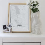
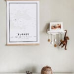
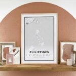
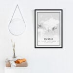
You may want to compare different places to hang or stand your print. A black United States map can break up colourful family photos on a gallery wall. A small United States map would look great in a children’s room. You could also choose a vintage United States map print to feature above a bookshelf. Make sure to measure the space and select the appropriate print size when you design your poster.
How to personalize your United States map art
If you want to design a custom United States map art, the Classic Mapiful tool makes it easy. Start by changing the location. You can choose any city or town in the United States. Or choose a landmark, such as the Grand Canyon.
Next, you can change the labels. If you want to make a personalized United States map poster, you can use your family name or the neighbourhood you live in. You can also use the automatic latitude and longitude label, or add a personal tagline.
Then pick a style that fits your décor. Think about whether you want a modern United States map, or a United States drawing map. There are many style options:
• Asphalt
- Nautical
- Blue
- Nära
- Gaia
- Pantone
- Humble
- Pink
- Sky
- Playroom
- Customized
The last step is to choose whether you want the print to be landscape or portrait and choose the print dimensions. The prints come in 11×17”, 18×24”, or 24×36”. Mapiful also offers metal or wood frames in several colours.
Can I design a map poster of the United States for any special occasion?
A custom United States map makes a great gift for birthdays, wedding anniversaries, or other life events. A map of the place you and your wife went on your first date, for example, makes a great Valentine’s gift. You could also give a map of your hometown to your parents for a sentimental holiday present. A United States map print makes a great gift for friends birthdays or “just because” presents, especially if they enjoy travel.
Useful Information Regarding the United States
Where is the United States located on the map?
The U.S. is located between the Pacific and Atlantic oceans.
What is the longitude and latitude of the United States?
37.0902° N, 95.7129° W.
To which continent does the United States Belong?
North America.
Which countries does the US border?
Canada is to the North and Mexico is to the South.
What are the oceans surrounding the United States?
The United States is surrounded by the Pacific and Atlantic Oceans.
What are the most important rivers in the United States?
The Mississippi River, the Hudson River, the Rio Grande, and the Colorado River.
What are the 50 States of the United States?
Alabama , Alaska , Arizona , Arkansas , California , Colorado , Connecticut , Delaware, Florida , Georgia , Hawaii , Idaho , Illinois, Indiana, Iowa , Kansas , Kentucky , Louisiana , Maine , Maryland , Massachusetts , Michigan , Minnesota , Mississippi , Missouri , Montana, Nebraska , Nevada , New Hampshire , New Jersey , New Mexico , New York , North Carolina , North Dakota , Ohio , Oklahoma , Oregon , Pennsylvania, Rhode Island , South Carolina , South Dakota , Tennessee, Texas , Utah , Vermont , Virginia , Washington , West Virginia , Wisconsin , Wyoming.
What is the capital of the United States?
Washington, D.C.
What are the top 10 cities in the United States?
- New York, NY.
- San Francisco, CA.
- Chicago, IL.
- Boston, MA.
- Washington, D.C.
- Los Angeles, CA.
- Austin, TX.
- San Diego, CA.
- Seattle, WA.
- Dallas, TX.
What is the population of the United States?
328.2 Million as of 2019.


")


